

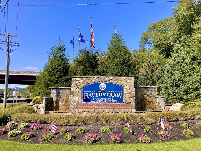
Historic Haverstraw Sign Introduce
For New Yorkers, our state is not just a place to live; it’s a living museum, teeming with layers of history that have shaped the nation. From the bustling streets of Manhattan to the serene landscapes of the Hudson Valley, echoes of the past are everywhere, if you know where to look. One such significant touchpoint, offering a fascinating glimpse into a pivotal part of New York’s story, is the Historic Haverstraw Sign located in Pomona, NY. This isn't a garden in the traditional sense, but rather a historical marker set within a landscaped area, serving as a gateway to understanding the rich heritage of the Town of Haverstraw.
The Historic Haverstraw Sign is more than just an informational plaque; it's a testament to the enduring legacy of a town that played a crucial role in both the discovery and the shaping of New York and the United States. It tells a captivating tale, starting from the very first European contact in 1609 when Henry Hudson's ship, the Half Moon, anchored in Haverstraw Bay, the widest point of the river that would eventually bear his name. The narrative unfolds through centuries, encompassing the origins of its unique Dutch name, its strategic importance during the Revolutionary War, and its remarkable industrial prowess as the "Brick Capital of the World."
This article will delve into the compelling history detailed at the Historic Haverstraw Sign, exploring its significance as a local landmark. We’ll cover its precise location and how to access it, the wealth of historical information it "offers" to visitors, and the unique features that make it a compelling stop for history enthusiasts and curious locals alike. Prepare to be transported back in time, understanding why Haverstraw's story is so deeply woven into the fabric of New York.
The Historic Haverstraw Sign is located at 394 US-202, Pomona, NY 10970, USA. This placement positions it along a key roadway, making it easily accessible for those traveling through Rockland County and the broader Hudson Valley region. US-202 is a significant thoroughfare that connects various towns and attractions in the area, ensuring that the sign is not a hidden gem but a readily discoverable piece of local history.
For New Yorkers traveling by car, reaching the Historic Haverstraw Sign is straightforward. From major highways such as the Palisades Interstate Parkway or the New York State Thruway (I-87), visitors can navigate towards US-202. The sign is typically visible from the road, making it easy to spot and pull over. While it's not a large park with extensive parking facilities, there is usually ample space available to safely stop and read the historical information. Given its nature as a roadside historical marker, direct street parking or a small pull-off area is generally available nearby, allowing for convenient access.
Public transportation options to this specific spot might be more limited compared to larger attractions. While bus routes may exist along portions of US-202, visitors relying on public transport should plan their journey carefully, potentially involving a combination of bus services or ride-sharing from nearby transit hubs. However, for most locals with access to a vehicle, the sign is an easy and quick stop to incorporate into a scenic drive through the area or a visit to other nearby historical or natural sites. Its year-round accessibility means that history enthusiasts can visit at their convenience, absorbing the rich narrative of Haverstraw at any time.
- Detailed historical information about the Town of Haverstraw, spanning from 1609 to the early 20th century.
- Insights into the exploration of Henry Hudson and the origins of the name "Haverstraw."
- Narrative of Haverstraw's pivotal role in the American Revolutionary War, including the Benedict Arnold treason plot.
- Information on the significant brick-making industry that thrived in Haverstraw.
- A static outdoor interpretive display for self-guided historical learning.
- Provides context for understanding the broader history of the Hudson Valley.
- An opportunity for visitors to engage with local heritage without an entrance fee.
- Comprehensive Historical Narrative: The sign provides an in-depth, multi-faceted history of Haverstraw, covering key periods from early Dutch exploration to its industrial heyday, offering a rich educational experience.
- Henry Hudson's Landing: Details the pivotal moment in 1609 when Henry Hudson's Half Moon anchored in Haverstraw Bay, marking one of the earliest European contacts in the region.
- Unique Name Origin: Explains that "Haverstraw" is a Dutch word, "Haverstroo," meaning "Oat Straw," descriptive of the river meadows, a fascinating linguistic insight.
- Revolutionary War Significance: Highlights Haverstraw's critical role in the defense of the colonies, particularly its strategic location on the Hudson River and its involvement in the infamous Benedict Arnold treason plot with Major John Andre.
- "Brick Capital of the Nation": Chronicles Haverstraw's immense importance as the greatest center of brick production in the nation (and perhaps the world) from 1771 to 1941, detailing its scale (42 brickyards, 300 million bricks shipped annually) and impact (constructing over two-thirds of NYC buildings).
- Geological Context: Indirectly references the "immense clay beds" that fueled the brick industry, connecting local geology to economic history.
- Visual Landmark: The sign itself acts as a clear and engaging visual landmark for those interested in local history, easily identifiable from the road.
- Free Public Access: As a roadside historical marker, it is freely accessible to anyone passing by, allowing for spontaneous learning.
As a historical marker and public interpretive display, the Historic Haverstraw Sign does not offer commercial "promotions" in the traditional sense, such as discounts or sales. Its value lies in its role as a free, accessible source of local history and cultural heritage. However, there are inherent "offers" that make it a valuable stop for locals:
- Free Historical Education: The most significant "offer" is the free and readily available in-depth historical information provided directly at the site. This allows anyone to learn about Haverstraw's past without any cost.
- Always Accessible: As a roadside sign, it is accessible 24/7, providing continuous learning opportunities at your convenience.
- Self-Guided Exploration: It empowers visitors to engage with history at their own pace, allowing for quiet reflection or detailed study of the narrative.
- Gateway to Further Exploration: The sign acts as a catalyst for further exploration of Haverstraw and the surrounding Hudson Valley. After learning about its rich history, visitors might be inspired to visit the actual Haverstraw village, explore Haverstraw Bay, or seek out other related historical sites mentioned (like the general area of "Treason House" or the route of Major Andre). This "offer" is the inspiration for deeper local tourism.
- Integration into a Scenic Drive: The sign's location on US-202 means it can be seamlessly incorporated into a scenic drive through Rockland County, adding a historical dimension to a recreational outing.
For more in-depth information about Haverstraw's history, local historical societies (such as the Haverstraw King's Daughters Public Library's local history collection or the Historical Society of Rockland County) would be excellent resources, though these are separate entities from the sign itself.
The Historic Haverstraw Sign itself does not have a direct contact office or phone number as it is a static historical marker. For inquiries related to the content of the sign, local history, or the general Town of Haverstraw, the relevant contacts would be municipal offices or local historical societies.
Address: 394 US-202, Pomona, NY 10970, USA (This is the physical location of the sign.)
For historical information or local government inquiries regarding the Town of Haverstraw:
Town of Haverstraw Official Website: Recommended for general town information.
Haverstraw King's Daughters Public Library (Local History Collection): (845) 786-3800 (for historical research and resources).
Historical Society of Rockland County: (845) 634-9629 (for broader county history and potential resources related to Haverstraw).
It's always best to consult the official websites of the Town of Haverstraw or the aforementioned historical organizations for the most accurate and up-to-date contact information and resources.
For New Yorkers, especially those residing in Rockland County and the broader Hudson Valley, the Historic Haverstraw Sign in Pomona is an exceptionally suitable and enriching local landmark. While not a traditional garden, its role as a clear, engaging historical marker makes it an invaluable resource for understanding the deep roots of our region.
Its primary suitability lies in its educational value and accessibility. The sign presents a concise yet comprehensive narrative of Haverstraw's pivotal role in New York's history, from its early Dutch encounters and unique name origins to its strategic importance during the Revolutionary War and its remarkable industrial heritage as the "Brick Capital of the Nation." This readily available information allows locals to connect with the very ground they live on, fostering a deeper appreciation for their community's past. The fact that it's a free, roadside exhibit means that historical learning is always convenient and requires no special planning or admission fees, making it perfect for a spontaneous stop.
Moreover, the compelling stories detailed on the sign, particularly those about Henry Hudson's landing, the Benedict Arnold plot, and the immense brick-making industry, transform abstract historical facts into vivid narratives. For locals, this contextualizes familiar landmarks and names, turning everyday drives into journeys through history. Knowing that "over two thirds of the buildings in New York City were constructed of Haverstraw brick" provides a profound and tangible link to the city's development right from our local area.
In essence, the Historic Haverstraw Sign is more than just a historical marker; it's a local treasure that encapsulates centuries of significant events and industrial prowess. It offers New Yorkers a unique opportunity to pause, reflect, and absorb the rich tapestry of their regional heritage, fostering a stronger sense of place and an enduring connection to the remarkable history that lies just beyond their doorsteps.
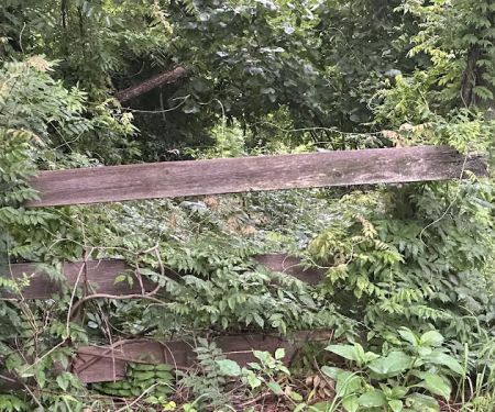
Historic Haverstraw Sign Photos
Historic Haverstraw Sign Location
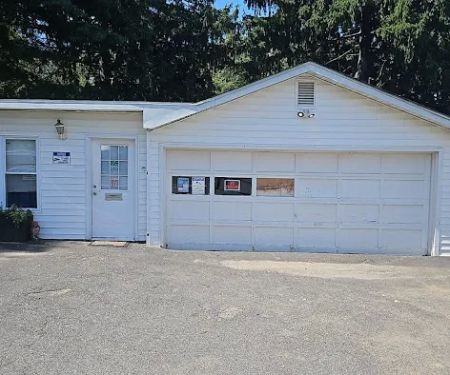
Historic Haverstraw Sign
394 US-202, Pomona, NY 10970, USA
 Historic Haverstraw Sign
394 US-202
 Parkway/ Mt. Ivy MHC Office
33 Old Rte 202
 Gurnee County Park
New City
 Gurnee Park & Amphitheater
Andreanna Park Rd
 South Mountain County Park
New City
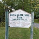 Burgess Meredith Park
31 Brookside Dr
 Samuel G Fisher Mount Ivy Environmental Park
75 Firemens Memorial Dr
 Samuel G Fisher Mount Ivy Environmental Park West entrance
20 Station Rd
 National Camp Association
74 Call Hollow Rd
 Davenport Preserve
New City
 Bogart’s Red Fuse Bike Trail
6A Beaver Dam Rd
 Eugene Levy Memorial Park
920 NY-45
 South Mountain County Park Trailhead
Co Rd 33
Historic Haverstraw Sign Reviews
Welcome to The Town of HaverstrawIn 1609 Henry Hudson, an Englishman employed by the Dutch East India Company, sailed his ship, the Half Moon, up the river that would bear his name in a vain search for the legendary Northwest passage. He sailed as far as what is now Albany and on the return trip the Half Moon anchored in what is now Haverstraw Bay, the widest point in the river. The ship had scarcely anchored when "the people of the mountains" flocked aboard. Most were friendly but one was shot and killed by a sailor for stealing some items from the ship. This incident created difficulties for future settlers but Hudson's journey claimed the whole Hudson Valley for the Dutch.The name of Haverstraw is one of the oldest in the geography of North America. The word is Dutch and it first appeared on a map in 1616. It was originally written, Haverstroo, and means "Oat Straw", descriptive of the waving straw of the river meadows.In 1666, the local native Americans, who were part of the Delaware's, who in turn were a component of the Lenni Lenape confederation of the Algonquins, sold a large tract of land along the river to Balthazar de Harte, a New York merchant. In 1671, he received a patent or land grant from the English government, which had taken over the territory from the Dutch in 1666.The precinct of Haverstraw was created in 1719 when it was separated from Orangetown. Haverstraw then included the present day Towns of Clarkstown, Ramapo and Stony Point. Haverstraw became a town in 1788. Clarkstown and Ramapo became separate towns in 1791 and Stony Point became a town in 1865.The location of Haverstraw was important to the defense of the colonies in the Revolutionary War because of its place on the banks of the Hudson, the main artery of trade between New York City and Albany and the dividing line between New England and other colonies.The Shore Guard was organized in Haverstraw to repel British or Tory landings along the Hudson. The Shore Guard lit signal fires on top of High Tor to warn neighboring communities of danger.In 1780 Haverstraw played a major role in a plot, which if it had succeeded could have changed the course of the Revolutionary War. American General Benedict Arnold, a hero of the battle of Saratoga, had persuaded George Washington to give him command of the fort at West Point. Washington was unaware that Arnold was involved in treasonable negotiations with the British.During the night of September 19th and 20th, the English Emissary, Major John Andre, was rowed from the sloop-of-war, Vulture, to a beach below the Long Cove in the Town of Haverstraw. The negotiations to sell the plans to West Point were not completed by dawn and Arnold and Andre traveled to the home of Joshua Het Smith on the grounds of what is now Helen Hayes Hospital. The house became known as Treason House and was unfortunately torn down in the late 1920's.The plot was foiled by Andre's capture in Tarrytown on his way back to British lines. Arnold fled to the British. The captured Andre traveled through Haverstraw once more on his way to his trial and subsequent execution in Tappan.Between 1771 and 1941, Haverstraw was the greatest center of brick production in the nation if not the world. Immense clay beds along the Hudson's shores and beneath its surface formed the raw material for this huge industry.In 1771, Jacob Van Dyke began the industry by making bricks by hand. James Wood started the first brickyard in Haverstraw in 1815. In 1852, a fresh impetus was added to the industry by Richard Ver Valen's invention of the automatic brick machine. In 1883, there were 42 brickyards in the area, which manufactured 148 brands of brick. In a single year over 300 million bricks were shipped out of Haverstraw Bay for the New York City area. At one time over two thirds of the buildings in New York City were constructed of Haverstraw brick.Haverstraw's greatest catastrophe was caused by the excavation of clay used in the manufacturing of bricks. On January 8th, 1906 a landslide occ
May 15, 2025 · יודי מעלבער
More Scenic Spot
 Parkway/ Mt. Ivy MHC Office0.0 (0 reviews)
33 Old Rte 202, Pomona, NY 10970, USA
 Gurnee County Park0.0 (0 reviews)
New City, NY 10956, USA
 Gurnee Park & Amphitheater4.0 (4 reviews)
Andreanna Park Rd, New City, NY 10956, USA
 South Mountain County Park0.0 (0 reviews)
New City, NY 10956, USA
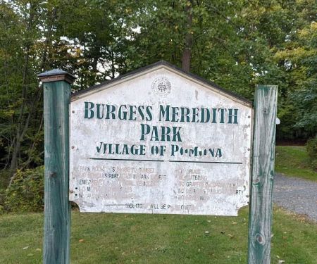 Burgess Meredith Park0.0 (0 reviews)
31 Brookside Dr, Pomona, NY 10970, USA
 Samuel G Fisher Mount Ivy Environmental Park4.0 (25 reviews)
75 Firemens Memorial Dr, Pomona, NY 10970, USA
 Samuel G Fisher Mount Ivy Environmental Park West entrance5.0 (1 reviews)
20 Station Rd, Pomona, NY 10970, USA
 National Camp Association4.0 (7 reviews)
74 Call Hollow Rd, Pomona, NY 10970, USA
 Davenport Preserve3.0 (4 reviews)
New City, NY 10956, USA
 Bogart’s Red Fuse Bike Trail5.0 (2 reviews)
6A Beaver Dam Rd, Pomona, NY 10970, USA
 Eugene Levy Memorial Park4.0 (646 reviews)
920 NY-45, New City, NY 10956, USA
 South Mountain County Park Trailhead4.0 (44 reviews)
Co Rd 33, New City, NY 10956, USA
Categories
Popular Camping Sites
 Mill River Park4.0 (1286 reviews)
 Lake Meahagh Park4.0 (45 reviews)
 Washington Park4.0 (329 reviews)
 Greene Garden5.0 (3 reviews)
 Joan of Arc Park4.0 (224 reviews)
 Garden Ct. Park3.0 (9 reviews)
Trending Camping Blog Posts
 Top Group Travel Destinations in Europe: Best Places for Group Vacations
 How to Get Involved in Travel Clans for Social Travel: Explore Group Travel Opportunities
 Best Travel Clans for Sustainable Travel
 Best Group Vacation Destinations for Friends: Ultimate Travel Ideas
 Travel Clans for Solo Travelers Looking for Company: Join Unique Travel Communities
 Best Travel Clans for Women Traveling Together