

Trail Stop Introduce
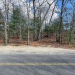
The "Trail Stop" located at Nassau - Suffolk Trail LIGTC CLIMB in Woodbury, NY 11797, serves as a crucial access point to the extensive Nassau-Suffolk Greenbelt Trail. This specific location, while not a standalone park with its own unique name beyond "Trail Stop," is recognized as a "Scenic Spot" because it provides direct entry into a significant natural corridor offering recreational services in the form of hiking and outdoor exploration. It is not a commercial establishment selling goods, but rather a public gateway to a diverse and challenging trail system that traverses Long Island.
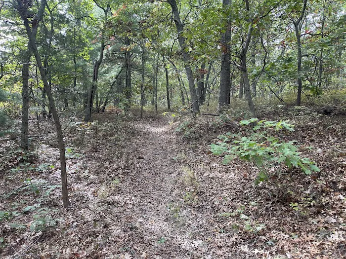
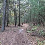
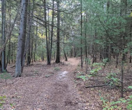
The environment surrounding this "Trail Stop" and along the Nassau-Suffolk Greenbelt Trail itself is surprisingly varied, considering its location within a densely populated area of Long Island. The trail, which spans approximately 20 miles (some sources say 19.5 or even 31.8 miles for the broader Greenbelt system, of which the Nassau-Suffolk Trail is a part), dissects the island from Cold Spring Harbor in the north to the Massapequa Preserve in the south. The northern portions, particularly near Cold Spring Harbor and including sections accessible from Woodbury, are characterized by "steep hills" and "rocky" terrain, providing an "aerobic workout." This contrasts with the flatter, sometimes "swampy" southern sections, which offer "wonderful views of lakes/ponds with lots of ducks and swans."
However, specific to the "Trail Stop" in Woodbury, customer reviews indicate that while the trail itself can be a "Favorite LI hike," the immediate environment near this access point can be less serene. One review explicitly mentions "Loud road and poison ivy in abundance." This suggests that portions of the trail near major roadways might experience significant traffic noise, impacting the tranquility often sought in nature. Furthermore, the prevalence of "poison ivy in abundance" highlights the need for hikers to be vigilant and adequately prepared, wearing appropriate clothing to prevent skin irritation. Despite these drawbacks, the trail weaves through diverse ecosystems, including mixed hardwood forests with oak, maple, and occasional pine stands. The understory is rich with ferns and shrubs, providing a lush green backdrop, especially during the growing season. Birdwatchers can enjoy a variety of songbirds, and with luck, white-tailed deer or other local wildlife might be spotted further along the trail.
In terms of services and features, the "Trail Stop" itself is primarily an access point. Its main service is providing entry to the Nassau-Suffolk Greenbelt Trail, which offers miles of singletrack hiking opportunities. The trail is generally "well-marked with blazes that are easy to follow," though carrying a navigation tool like a map or a GPS app is always recommended for a more informed experience. While the trail doesn't typically feature amenities like built-in restrooms or water fountains at every point, it crosses numerous roads and passes through various parks along its 20-mile stretch. Therefore, hikers can "expect to find water and bathrooms at most parks that the trail passes through," which can be utilized for day hikes or longer traverses.
The Nassau-Suffolk Greenbelt Trail offers a variety of terrain, making it suitable for different levels of hikers and trail runners. While much of Long Island is relatively flat, the northern sections provide "some relatively steep hills to climb," making them popular for a more challenging workout. The trail also shares corridors with mountain biking trails and paved bike paths in certain areas, such as through Trailview State Park, allowing for multi-use recreation. Near Stillwell Woods Park in Woodbury, one of the largest and most popular access points to the Greenbelt, there's an additional network of mountain biking and hiking trails, along with sporting fields, expanding the recreational opportunities available near this "Trail Stop."
The Long Island Greenbelt Trail Conference (LIGTC) plays a crucial role in maintaining and promoting the Nassau-Suffolk Greenbelt Trail. They are responsible for developing, building, and maintaining hiking trails, protecting hiking trail lands, and educating the public on responsible trail use. This organization often publishes detailed trail maps and guidebooks, which are invaluable resources for users planning their hikes. While there are no listed campsites or shelters directly on the 20-mile Nassau-Suffolk Greenbelt Trail for thru-hikers, camping may be available at adjacent Battle Row Campground in Old Bethpage. The LIGTC also sometimes offers guided hikes or workshops that serve as a form of community service and promotion.
Promotional information for the "Trail Stop" and the broader Nassau-Suffolk Greenbelt Trail is primarily disseminated through hiking communities, outdoor recreation websites, and local conservation organizations. The trail's status as a "National Recreation Trail" since 1992 lends it significant credibility and promotes its importance as a preserved natural corridor amidst urban development. Online platforms like Strava and Hiking Project feature detailed maps, segments, elevation profiles, and user reviews, all contributing to its promotion among hikers and trail runners. These reviews often highlight the "surprising diversity" of the trail's flora and fauna, including blooming mountain laurel in summer at the northern end and numerous bird species in the Massapequa Preserve to the south.
Despite the occasional "loud road" noise near certain access points and the presence of "poison ivy," the overall sentiment from the hiking community is positive, with many considering it a "tremendous experience" and a "favorite LI hike." The challenging terrain of the northern sections is often highlighted as a draw for those seeking a more rigorous workout. The ability to access the trail from countless points, including the "Trail Stop" in Woodbury, provides tremendous flexibility for day hiking or trail running, allowing users to tailor their outings to their desired length and difficulty. The ongoing efforts by organizations like the LIGTC, including recent projects to construct raised walkways in muddy areas of the Massapequa Preserve, demonstrate a continued commitment to improving the trail experience for all users, further enhancing its appeal as a valuable "Scenic Spot" on Long Island.
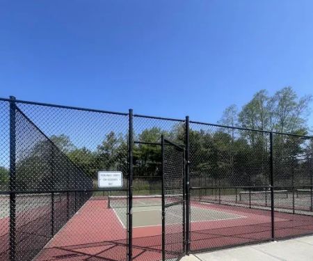
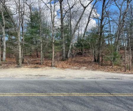
Trail Stop Photos

Trail Stop Location
Trail Stop
Nassau - Suffolk Trail LIGTC CLIMB, Woodbury, NY 11797, USA
 Trail Stop
Nassau - Suffolk Trail LIGTC CLIMB
 Town of Oyster Bay Plainview P-31 Park
Woodbury
 Sweet Hollow Park
51 Old Country Rd
 Stephen Drive Park
44 Stephen Dr
 West Hills County Park Office
10 Highhold Dr
 West Hills Nature Preserve
6 Country Meadow Ct
 Oheka Castle
135 W Gate Dr
 Bob Permit Service Inc.
1109 Round Swamp Rd
 Emma's Garden
30 E Gate Dr
 West Hills Preserve Trail Head
498-494
 West Hills Big Dog Run
Sweet Hollow Rd
 Robbins Lane Community Park
284-
 William Kessler Park
525 Sweet Hollow Rd
Trail Stop Reviews
Loud road and poison ivy in abundance made this local trail anything but relaxing
Apr 26, 2021 · Tamara AvivFavorite LI hike
Jan 14, 2023 · tom “DJ Google” king- Aug 26, 2024 · Christinia Green
- Jul 30, 2019 · Peter L
More Scenic Spot
 Town of Oyster Bay Plainview P-31 Park3.0 (13 reviews)
Woodbury, NY 11797, USA
 Sweet Hollow Park4.0 (153 reviews)
51 Old Country Rd, Melville, NY 11747, USA
 Stephen Drive Park2.0 (2 reviews)
44 Stephen Dr, Plainview, NY 11803, USA
 West Hills County Park Office5.0 (2 reviews)
10 Highhold Dr, Huntington, NY 11743, USA
 West Hills Nature Preserve4.0 (41 reviews)
6 Country Meadow Ct, Melville, NY 11747, USA
 Oheka Castle4.0 (1901 reviews)
135 W Gate Dr, Huntington, NY 11743, USA
 Bob Permit Service Inc.0.0 (0 reviews)
1109 Round Swamp Rd, Old Bethpage, NY 11804, USA
 Emma's Garden4.0 (39 reviews)
30 E Gate Dr, Huntington, NY 11743, USA
 West Hills Preserve Trail Head4.0 (9 reviews)
498-494, Sweet Hollow Rd, Melville, NY 11747, USA
 West Hills Big Dog Run4.0 (229 reviews)
Sweet Hollow Rd, Huntington, NY 11743, USA
 Robbins Lane Community Park4.0 (55 reviews)
284-, 294-295 Robbins Ln, Syosset, NY 11791, USA
 William Kessler Park4.0 (16 reviews)
525 Sweet Hollow Rd, Melville, NY 11747, USA
Categories
Popular Camping Sites
 Harrybrooke Park4.0 (170 reviews)
 Gould Park4.0 (120 reviews)
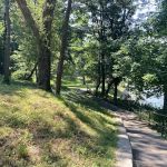 Dogwood Park5.0 (1 reviews)
 Highbridge Park Dog Run3.0 (9 reviews)
 John Vincent Daniels Jr. Square4.0 (30 reviews)
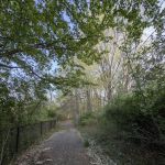 Patriots Trail/ Connect Hanover4.0 (3 reviews)
Trending Camping Blog Posts
 Top Group Travel Destinations in Europe: Best Places for Group Vacations
 How to Get Involved in Travel Clans for Social Travel: Explore Group Travel Opportunities
 Best Travel Clans for Sustainable Travel
 Best Group Vacation Destinations for Friends: Ultimate Travel Ideas
 Travel Clans for Solo Travelers Looking for Company: Join Unique Travel Communities
 Best Travel Clans for Women Traveling Together