

Belt Parkway Introduce
Welcome, New Yorkers! When we think of iconic city infrastructure, our minds often jump to the subway or bustling avenues. But for those in Brooklyn and Queens, and frankly, anyone navigating the outer boroughs, the Belt Parkway holds a special place. More than just a road, it's a gateway to some of the city's most beautiful waterfront views, convenient access to recreational spots, and a crucial artery connecting vibrant communities. This article will serve as your friendly, factual guide to understanding the Belt Parkway, helping you appreciate its role in our daily lives and how you can best utilize it for your adventures across the boroughs.
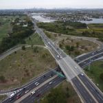
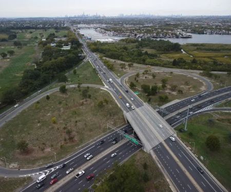
The Belt Parkway, officially designated as a series of controlled-access parkways, forms a significant "belt-like" path around the southern portions of Brooklyn and Queens. It's a combination of several historic parkways, including the Shore Parkway, the Southern Parkway (not to be confused with the Southern State Parkway), and the Laurelton Parkway, all contributing to its approximately 25-mile length. Conceived by the visionary urban planner Robert Moses, construction began in 1934, with major sections opening to great fanfare in 1940. The original design prioritized a park-like aesthetic, with landscaped roads and grade separations to facilitate smooth traffic flow, a forward-thinking approach for its time. Over the decades, it has evolved to meet the demands of our bustling city, undergoing expansions and improvements to ensure its continued functionality and scenic appeal. It truly is a testament to the city's enduring commitment to infrastructure that supports both efficient transit and recreational opportunities.
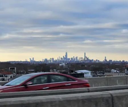
The Belt Parkway's address, for general navigation, is Belt Pkwy, Brooklyn, NY 11234, USA. However, it’s important to remember that this is a sprawling roadway with numerous entry and exit points across Brooklyn and Queens. Its western terminus is near the Brooklyn-Queens Expressway (I-278) in Bay Ridge, Brooklyn, just north of the majestic Verrazzano-Narrows Bridge, which itself has direct connections to the parkway. As it winds eastward, it seamlessly transitions into Queens, eventually meeting the Cross Island Parkway and the Southern Parkway at the Queens-Nassau county line.
Accessibility to the Belt Parkway is generally excellent due to its numerous interchanges with major thoroughfares and local streets. For drivers, the parkway offers multiple exit and entrance ramps, making it a convenient route for commuting or exploring the outer boroughs. Public transportation options, while not directly on the parkway itself, provide connections to areas adjacent to the parkway. Many MTA bus lines serve communities that border the Belt Parkway, offering transfer opportunities to local subway lines that can bring you close to various parkway exits and attractions. For instance, areas like Sheepshead Bay, Marine Park, and Gateway Center are all well-served by public transit, allowing for indirect access to the parkway's vicinity. Additionally, ongoing projects, like the nearing completion of pedestrian access points at locations such as 14th Avenue in Dyker Beach, are continuously improving accessibility for pedestrians and cyclists to the green spaces that often run parallel to the parkway. It's always advisable to check real-time traffic updates and public transit schedules, especially during peak hours, to plan your journey effectively.
Services Offered:
- Direct connectivity to key New York City boroughs (Brooklyn, Queens) and major expressways (I-278, I-678, Cross Island Parkway).
- Access to John F. Kennedy International Airport (JFK) via direct exits and connecting roads like the Nassau Expressway and Van Wyck Expressway.
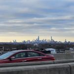
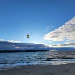
- Scenic driving routes along the waterfront, offering picturesque views of the Upper New York Bay and Jamaica Bay.
- Designated service areas, such as the Marine Park Service Area, providing amenities like gas services.
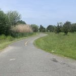
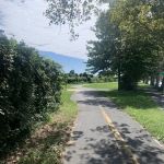
- Integration with the Shore Parkway Greenway, offering pedestrian and bicycle paths for recreational activities in various sections.
Features / Highlights:
- Historically significant design: The Belt Parkway was designed with a park-like character, featuring landscaped medians and tree-lined stretches, distinguishing it from typical expressways.
- Waterfront vistas: Enjoy stunning views of the bay and shoreline at various points, particularly along the Shore Parkway section in Brooklyn. There are even small parking areas designed as viewing spots for the bay.
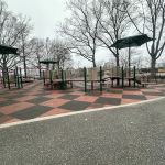
- Access to parks and recreational areas: The parkway provides direct access to numerous local parks and green spaces, including Dyker Beach Park and Golf Course, Shore Road Park, Marine Park, Plum Beach, Shirley Chisholm State Park, and Spring Creek Park.
- Architectural interest: Many of the bridges along the Belt Parkway, built in the 1940s, boast historic designs, incorporating elements that maintain a consistent historical character while undergoing modern improvements for safety and capacity.
- Strategic transportation link: It serves as a vital circumferential route, easing congestion on local streets and providing efficient travel between different parts of Brooklyn and Queens, as well as connections to Long Island.
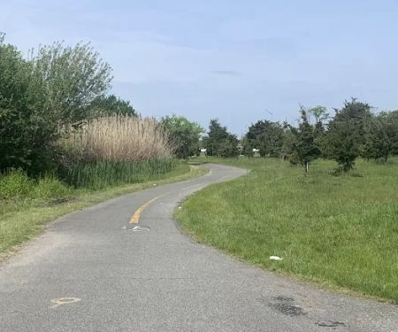
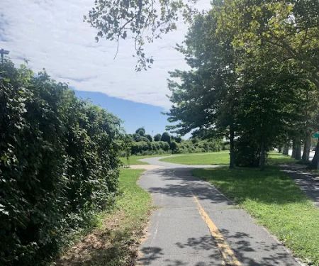
- Multi-use paths: Sections of the parkway, particularly the Shore Parkway Greenway, feature dedicated paths for walking, jogging, and biking, allowing New Yorkers to enjoy the waterfront scenery on foot or by bike.
As a major public roadway, the Belt Parkway itself does not typically offer direct promotions or special offers in the way a commercial establishment would. However, its existence significantly enhances access to numerous local businesses, attractions, and recreational facilities that frequently run their own promotions. For instance, being able to quickly reach Gateway Center in Brooklyn means you can take advantage of their various retail discounts, dining specials at eateries like Smashburger or Olive Garden, or events they might host. Similarly, its proximity to cultural institutions and entertainment venues in both Brooklyn and Queens allows easy access to their ticketing promotions, special exhibitions, or concert series. Local community events and festivals held in parks adjacent to the parkway, such as those in Marine Park or Dyker Beach Park, often have free admission or promotional activities that become more accessible thanks to the Belt Parkway. Keep an eye on local business associations, community calendars, and individual establishment websites for promotions tied to specific destinations you can reach via the Belt Parkway.
For general inquiries related to the Belt Parkway, such as road conditions, construction updates, or general information, the best approach is to consult official New York City and New York State Department of Transportation resources.
Address: Belt Pkwy, Brooklyn, NY 11234, USA (This address represents a general location along the parkway. For specific points, refer to exit numbers or cross streets.)
Phone: As a major public roadway, there isn't a direct phone number for the "Belt Parkway" itself. For real-time traffic information, you can dial 511 within New York State, or visit the New York State Department of Transportation (NYSDOT) website for current road conditions and advisories. For emergencies, always dial 911.
The Belt Parkway is more than just a thoroughfare; it's an integral part of the New York City experience, particularly for those of us in Brooklyn and Queens. Its strategic location provides unparalleled convenience for daily commutes, weekend getaways, and exploring the diverse neighborhoods that flank its route. For locals, it means quick access to some of the city's most beautiful waterfront parks, perfect for a run, a bike ride, or simply enjoying a sunset over the bay. It connects us to vital amenities, cultural landmarks, and shopping centers, making our lives a little easier and a lot more connected. Whether you're heading to JFK for a trip, meeting friends in another borough, or simply seeking a scenic drive to clear your head, the Belt Parkway remains a reliable and picturesque option. It truly serves as a continuous park system, offering both efficient travel and opportunities for recreation, making it an indispensable part of our New York lives.
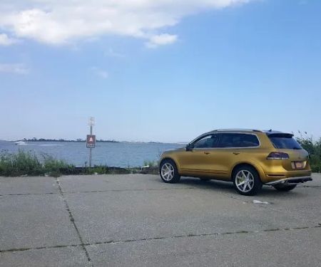
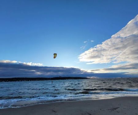
Belt Parkway Photos


Belt Parkway Location
Belt Parkway
Belt Pkwy, Brooklyn, NY 11234, USA
 Belt Parkway
Belt Pkwy
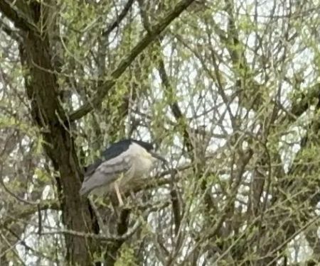
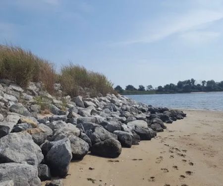
 Four Sparrow Marsh
Belt Pkwy &
 Highest Elevation On Belt Parkway
Belt Pkwy
 Jean Bourque Marsh Lookout
Hiking Trail
 North Forty Natural Area
Hiking Trail
 Jamaica Bay Trail
Jamaica Bay Greenway
 Marine Parkway Bridge Connector
Belt Pkwy
 White Island
Shore Pkwy
 Lindower Park
Strickland Ave
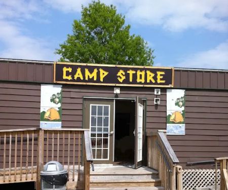
 Camp Gateway Brooklyn Tamarak and Goldenrod
Floyd Bennett Field
 Clam Shell Pathl
Jamaica Bay Greenway
 Camp Gateway: Wiley Post A
Brooklyn
 Gateway National Recreation Area
H4Q6+R5
Belt Parkway Reviews
More Scenic Spot
 Four Sparrow Marsh5.0 (2 reviews)
Belt Pkwy &, Flatbush Ave, Brooklyn, NY 11234, USA
 Highest Elevation On Belt Parkway5.0 (3 reviews)
Belt Pkwy, Brooklyn, NY 11234, USA
 Jean Bourque Marsh Lookout4.0 (6 reviews)
Hiking Trail, Brooklyn, NY 11234, USA
 North Forty Natural Area4.0 (20 reviews)
Hiking Trail, Brooklyn, NY 11234, USA
 Jamaica Bay Trail4.0 (3 reviews)
Jamaica Bay Greenway, Brooklyn, NY 11234, USA
 Marine Parkway Bridge Connector5.0 (2 reviews)
Belt Pkwy, Brooklyn, NY 11234, USA
 White Island4.0 (22 reviews)
Shore Pkwy, Brooklyn, NY 11234, USA
 Lindower Park4.0 (354 reviews)
Strickland Ave, Brooklyn, NY 11234, USA
 Camp Gateway Brooklyn Tamarak and Goldenrod3.0 (89 reviews)
Floyd Bennett Field, Brooklyn, NY 11234, USA
 Clam Shell Pathl5.0 (2 reviews)
Jamaica Bay Greenway, Brooklyn, NY 11234, USA
 Camp Gateway: Wiley Post A4.0 (17 reviews)
Brooklyn, NY 11234, USA
 Gateway National Recreation Area4.0 (2 reviews)
H4Q6+R5, Brooklyn, NY 11234, USA
Categories
Popular Camping Sites
 Coney Island Boardwalk Garden4.0 (75 reviews)
 The William Hotel Midtown, Sonder4.0 (555 reviews)
 Shepard Lake Recreation Area0.0 (0 reviews)
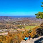 Stairway To Heaven4.0 (185 reviews)
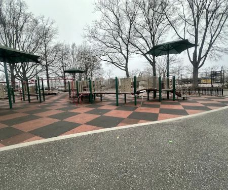
 Howard Bennett Playground4.0 (152 reviews)
 Isle of Meadows4.0 (10 reviews)
Trending Camping Blog Posts
 Top Group Travel Destinations in Europe: Best Places for Group Vacations
 How to Get Involved in Travel Clans for Social Travel: Explore Group Travel Opportunities
 Best Travel Clans for Sustainable Travel
 Best Group Vacation Destinations for Friends: Ultimate Travel Ideas
 Travel Clans for Solo Travelers Looking for Company: Join Unique Travel Communities
 Best Travel Clans for Women Traveling Together