
Ives Trail Introduce
For those of us living in Connecticut, the desire to immerse ourselves in nature and explore the beauty of our state is a constant draw. The Ives Trail offers an unparalleled opportunity to do just that. This isn't just a single path; it's a magnificent regional greenway, spanning approximately 17 to 20 miles, that gracefully connects a network of parks and open spaces across four charming towns in Fairfield County: Ridgefield, Danbury, Bethel, and Redding. It’s a testament to local collaboration and conservation, allowing us to traverse diverse landscapes right here in our own backyard.
The Ives Trail is dedicated to the legacy of Charles Edward Ives (1874-1954), a venerable American modernist composer and a native of Danbury. Ives, inspired by the natural environment of his home, often communed with nature on Pine Mountain, a prominent feature of the trail. This connection to a celebrated local figure adds a rich historical and cultural dimension to the trail, making every step a journey through nature and history. Whether you're seeking a "steep hike" for a challenge or a "flat and narrow" path for a leisurely stroll, the Ives Trail provides varied terrain to suit different preferences. While some sections might be "full of weeds at some places" or occasionally feature "loud noises" (likely from nearby areas, as mentioned in reviews), the overall experience is one of engaging with Connecticut's breathtaking natural landscapes. It’s an adaptable and evolving resource, continuously maintained by the Ives Trail and Greenway Regional Association, ensuring that it remains a cherished outdoor escape for generations to come.
The Ives Trail is a regional greenway, meaning it doesn't have a single, definitive entrance point. Instead, it offers multiple access points and traverses various parks and open spaces across four towns: Danbury, Ridgefield, Bethel, and Redding. One commonly cited access point in Danbury is near 36 Sugar Hollow Rd, Danbury, CT 06810, USA, though this is just one of several.
Key access points and parking locations along the Ives Trail include:
Ridgefield:
- Bennett's Pond State Park (550 Bennetts Farm Rd, Ridgefield, CT): This is a major trailhead with ample parking, though it can fill up on busy days.
- Pine Mountain Reserve (175 Pine Mountain Rd, Ridgefield, CT).
Danbury:
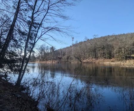
- Wooster Mountain State Park (west side of Route 7, Danbury, CT, and a DEP Trailhead on the east side of Route 7).
- Tarrywile Park (70 Southern Blvd, Danbury, CT): Features a large, active parking lot and is considered safe for leaving vehicles.
- United Methodist Church (201 Long Ridge Rd, Danbury, CT): Offers parking, usually accessible except on Sundays.
Redding:
- Near West Redding RR Station (248 Simpaug Turnpike, Redding, CT): This is the nearest parking for the Sidecut Road terminus.
- Sidecut Road: The trail itself begins inconspicuously about 1/4 mile down Sidecut Road on the left-hand side, though parking can be limited here.
Bethel:
- Terre Haute open space.
The trail is well-marked with a distinctive G-clef musical symbol inside a red circle on a yellow diamond, making navigation relatively easy, though paying attention to side trails is advised. While parts of the trail can be rugged and steep, bypass routes are often available. The trail includes minimal road crossings, enhancing the immersive nature experience. For detailed maps of specific sections (Southwest, Northern, Southeast), it’s best to consult the official Ives Trail website, which provides downloadable maps and parking guidance. This extensive network of access points ensures that residents from various parts of Fairfield County can conveniently reach and enjoy different segments of this expansive greenway.
The Ives Trail primarily serves as a multi-purpose greenway, offering a range of outdoor recreational opportunities and contributing to local conservation efforts. While it doesn't have traditional "services" like a visitor center or rentals, its core offerings revolve around access to nature and community engagement:
Hiking and Backpacking: The trail's primary use is for hiking, with varied terrain ranging from easy strolls to "steep" and challenging sections. It's suitable for day hikes and can be combined for longer backpacking experiences.
Mountain Biking (Select Sections): Certain sections of the trail are open to mountain bikes, particularly within Wooster Mountain State Park (west of Route 7), Tarrywile Park, and the Terre Haute section in Bethel. Hikers should be aware of shared use in these areas.
Horseback Riding (Select Sections): Similar to mountain biking, some parts of the trail are accessible for horseback riding, providing equestrian enthusiasts with scenic routes through the open spaces.
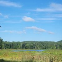
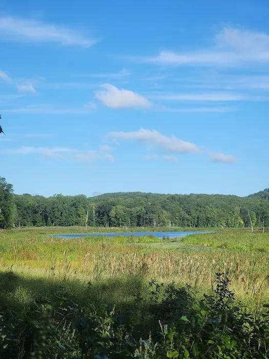
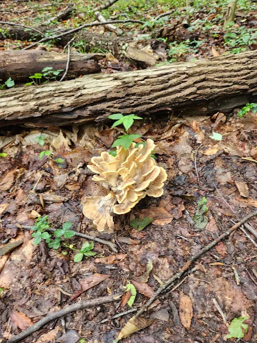
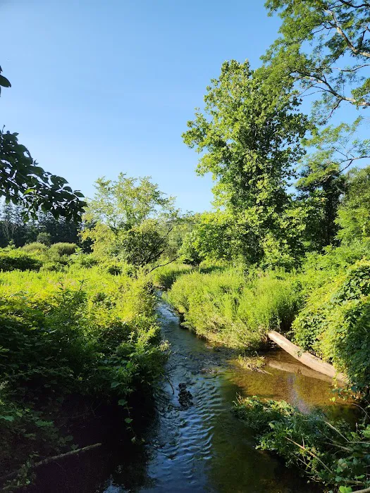
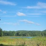
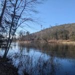
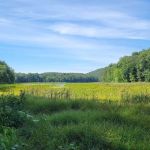
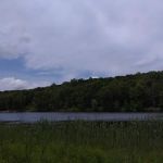
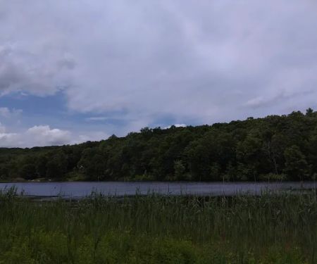
Wildlife Observation & Birdwatching: The diverse landscapes, including lush forests, tranquil waterways, and open meadows, create excellent opportunities for observing local flora and fauna. Birdwatching is particularly rewarding around Bennett's Pond, Wiedel Meadows, and the meadows in Tarrywile Park.
Picnicking: Many of the parks and open spaces connected by the Ives Trail, such as Tarrywile Park, offer designated picnic areas, allowing visitors to enjoy meals amidst natural surroundings.
Nature Education: The trail itself, with its varied ecosystems and historical points, serves as an informal outdoor classroom, encouraging appreciation and understanding of the local environment and geology.
Commemorative Patch Program: Hikers who complete the entire Ives Trail can apply for a commemorative patch, acknowledging their accomplishment. This encourages long-distance hiking and celebrates the trail's completion.
Volunteer Opportunities: The Ives Trail and Greenway Regional Association actively encourages community involvement through volunteering for trail building, marking, and maintenance tasks, allowing locals to directly contribute to the preservation of this valuable resource.
The Ives Trail is rich with natural beauty, historical significance, and diverse terrain, offering several compelling highlights:
Regional Connectivity: As a 17 to 20-mile greenway, its most prominent feature is its ability to link numerous parks and open spaces across four distinct Connecticut towns (Ridgefield, Danbury, Bethel, and Redding). This creates an expansive network for continuous outdoor exploration.
Tribute to Charles Ives: The trail is named in honor of Danbury-native composer Charles Edward Ives, who found inspiration in the local natural environment. This connection to a Pulitzer Prize-winning artist imbues the trail with a unique cultural and historical depth, particularly at sites like Pine Mountain Lookout, where Ives is believed to have composed.
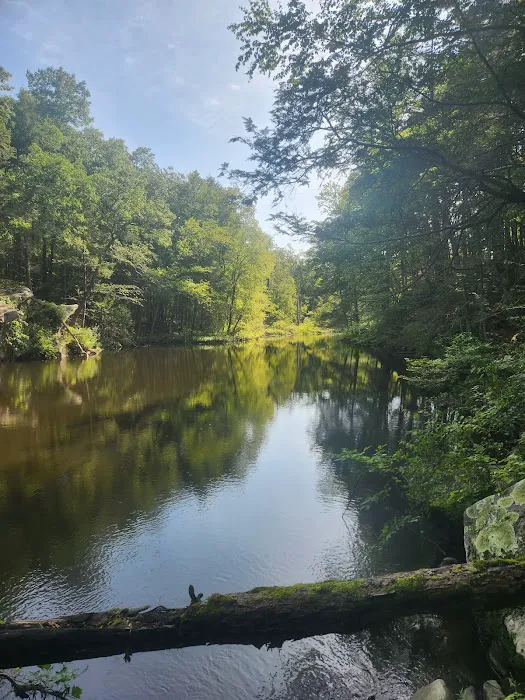
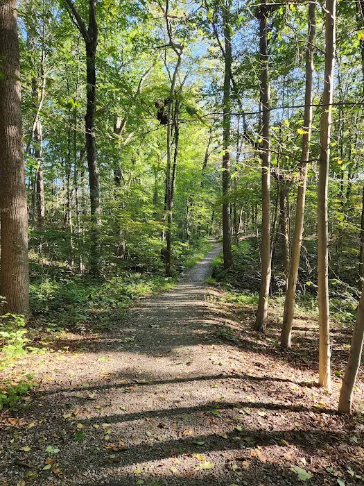
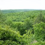
Varied Terrain and Scenery: The trail offers a wide range of landscapes, from "steep" and "rugged" sections that challenge experienced hikers to "flat and narrow" paths for easier walks. It traverses rolling hills, open fields, lush forests, wetlands, and features views of small lakes and reservoirs.
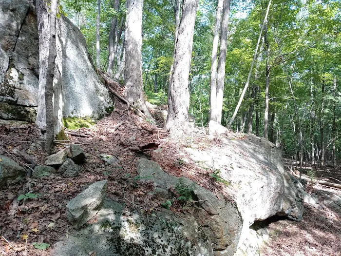
Geological Wonders: Particularly in the Pine Mountain section, visitors can observe impressive glacial erratics – large rocks left behind by glaciers – providing fascinating insights into Connecticut's geological past.
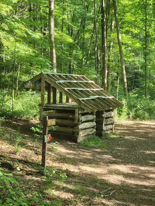
Historical Sites Along the Way: The trail passes by significant historical landmarks, including Hearthstone Castle (within Tarrywile Park) and old ruins like lime kilns, whiskey stills, and charcoal ovens, offering glimpses into the region's industrial and agricultural history.
Pine Mountain Lookout: A highlight of the Ridgefield section, this site was once home to Charles Ives's lean-to shanty and offers panoramic views that, on a clear day, can extend to Long Island Sound. It’s a powerful vantage point for experiencing the regional landscape.
Diverse Ecosystems: The trail meanders through a variety of habitats, including mature hardwood forests, open meadows, and wetland areas, supporting a rich diversity of flora and fauna, making it excellent for nature observation and birdwatching.
Distinctive Trail Markers: The unique G-clef musical symbol inside a red circle on a yellow diamond serves as the official trail marker, making navigation intuitive and adding to the trail's unique identity.
As a publicly accessible greenway, the Ives Trail itself does not typically offer commercial "promotions" or "special offers" in the retail sense. Access to the trail is free. However, there are ways the trail promotes engagement and offers value to its users and supporters:
Commemorative Patch Program: For dedicated hikers, the Ives Trail offers a unique "promotion" – a commemorative patch for those who complete the entire trail. This serves as a tangible reward and recognition of their achievement. Details for obtaining this patch (usually a small fee for shipping/materials) are available through the Ives Trail and Greenway Regional Association.
Membership Opportunities: The Ives Trail and Greenway Regional Association (IT&GRA) is a 501(c)(3) non-profit organization that offers individual ($20) and family ($40) memberships. While not a "promotion" in the discount sense, membership provides an opportunity for locals to directly support the maintenance and development of the trail, ensuring its continued accessibility and quality.
Volunteer Events: Regular volunteer work parties for trail maintenance and building are excellent "offers" for locals who want to give back to their community and spend time outdoors. These events are often announced on the IT&GRA website or social media.
Guided Hikes and Events: Local conservation groups, the various parks the trail passes through (like Tarrywile Park), or the IT&GRA may occasionally host guided hikes, educational walks, or other community events on sections of the Ives Trail. These are often free or low-cost and are promoted through local community calendars or their respective websites.
Informational Resources: The official Ives Trail website provides free, downloadable maps and detailed information about the trail's various sections, features, and history. This readily available information is a valuable resource for planning a visit and exploring the trail.
To learn about any current community events, volunteer opportunities, or how to obtain the completion patch, it's best to visit the official Ives Trail website or contact the Ives Trail and Greenway Regional Association directly.
For inquiries related to the Ives Trail, you can typically reach out to the Ives Trail and Greenway Regional Association (IT&GRA) or the City of Danbury's Parks and Recreation Department, as Danbury played a key role in the trail's development.
Address (General Danbury Area Contact): 36 Sugar Hollow Rd, Danbury, CT 06810, USA (Note: This is a general area for one of the access points, not a specific administrative office).
Phone (City of Danbury Parks and Recreation, which can likely direct inquiries): (203) 797-4632 (also listed as +1 203-797-4632).
Ives Trail and Greenway Regional Association (IT&GRA):
Email: ivestrl@yahoo.com
Postal Mail for Membership/Donations: IT&GRA, c/o Tarrywile Mansion, 70 Southern Boulevard, Danbury, CT 06810.
Website: The most comprehensive source of information is the official Ives Trail website (ivestrail.org). This site provides detailed maps, news updates, information on supporting the trail, and a gallery of photos.
For specific sections of the trail that pass through state parks (e.g., Bennett's Pond State Park, Wooster Mountain State Park), information might also be available through the Connecticut Department of Energy and Environmental Protection (DEEP). For Tarrywile Park specific inquiries, their direct phone (203) 744-3130 is also a useful contact.
For us Connecticut locals, the Ives Trail is an extraordinary resource that embodies the very best of our state's natural beauty, historical depth, and community spirit. Its unique characteristics make it exceptionally suitable for residents across Fairfield County and beyond.
Firstly, the sheer scope and diversity of the trail are unparalleled. Spanning 17 to 20 miles and connecting four towns, it offers an incredible range of hiking experiences. Whether you're an avid hiker seeking a challenging "steep" ascent or a family looking for a leisurely walk on "flat and narrow" paths, the Ives Trail caters to all fitness levels and preferences. This variety means you can return to different sections of the trail time and again and discover new landscapes, from lush forests and open fields to tranquil ponds and impressive geological formations.
Secondly, the deep historical and cultural ties, particularly its dedication to composer Charles Ives, add a unique layer of richness to every visit. Walking the same landscapes that inspired a renowned artist creates a profound connection to our state's heritage. The presence of historical ruins along the path further immerses us in the past, offering glimpses into the lives of those who shaped our region. It's more than just a hike; it's a journey through time.
Moreover, the Ives Trail represents a remarkable collaborative effort in local conservation. Maintained by the Ives Trail and Greenway Regional Association with support from various towns and land trusts, it showcases a collective commitment to preserving open spaces for public enjoyment. This community-driven spirit means that locals have a direct stake in its upkeep and future, fostering a sense of pride and stewardship. The opportunity to volunteer or become a member allows residents to actively contribute to this invaluable resource.
In conclusion, the Ives Trail is a quintessential Connecticut experience, offering a robust network of trails that are accessible, diverse, historically rich, and lovingly maintained by the community. It provides an ideal escape into nature, a chance to connect with our heritage, and a healthy outlet for outdoor activity, making it a perfect destination for us locals seeking adventure, tranquility, or simply a deeper appreciation for the beauty of our home state.
Ives Trail Photos


Ives Trail Location
Ives Trail
36 Sugar Hollow Rd, Danbury, CT 06810, USA
 Ives Trail
36 Sugar Hollow Rd
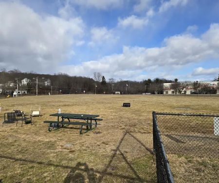
 Ives Trail (Parking Area)
Danbury
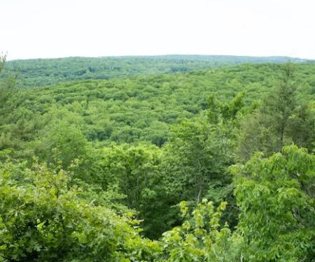
 Wooster Mountain State Park Scenic Reserve
Sugar Hollow Rd
 Danbury Dog Park
76 Miry Brook Rd
 Pine Mountain Trail Head
Ridgefield
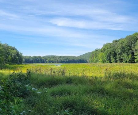
 Bennetts Pond State Park
550-698 Bennetts Farm Rd
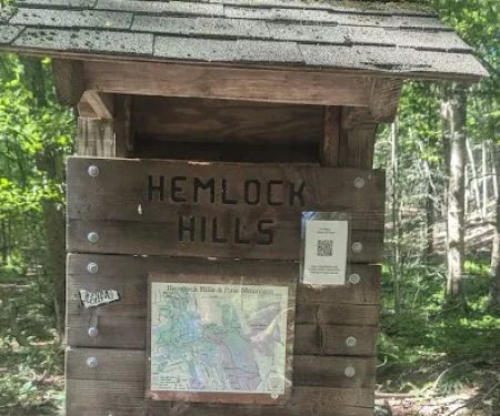
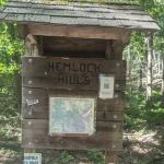 Hemlock Hills Parking Bear Mountain Rd
29 Bear Mountain Rd
 Tarrywile Park
70 Southern Blvd
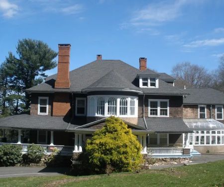
 Residence Inn Danbury
22 Segar St
 Lake Windwing
Ridgefield
 Ethan Allen Hotel
21 Lake Ave Ext
 Casa branca
21 Park Ave
 Maron Hotel & Suites
42 Lake Ave Ext
Ives Trail Reviews
left trail was more streep and ok but right side trail was flat and narrow , full of weeds at some places. Some loud noises heard not sure what was it. Saw snake , frog 🐸
Jul 28, 2024 · DishaNice steep h8ke to all trails😎
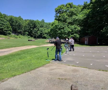
Jan 08, 2025 · Mike GovanIt's a fine trail, with some elevation gain, but very close to rt7. Don't go on the weekend, as the shooting range (open sat/sun) is across rt7, and you'll hear lots of gunshots.It's a fine walk if you live nearby, and just want a quick hike, but it is not worth a detour.(We found it because we wanted to hike Tarrywhile Park in Danbury, but it was closed for a wedding.)Others have mentioned the parking lot is easy to miss... They're right!
Oct 12, 2024 · Tita AThis section is about a half mile around the pond heading into Wooster Mountain across the road. It's fairly overgrown and the sound of traffic and shooting (from the gun range at Wooster) is all very loud. Good place to start a hike, but not worth hanging out.
Jun 30, 2024 · A AAIt was very good. Great nature walk
Apr 16, 2025 · John Dickinson
More Scenic Spot
 Ives Trail (Parking Area)3.0 (1 reviews)
Danbury, CT 06810, USA
 Wooster Mountain State Park Scenic Reserve4.0 (75 reviews)
Sugar Hollow Rd, Danbury, CT 06810, USA
 Danbury Dog Park4.0 (159 reviews)
76 Miry Brook Rd, Danbury, CT 06810, USA
 Pine Mountain Trail Head4.0 (25 reviews)
Ridgefield, CT 06877, USA
 Bennetts Pond State Park4.0 (66 reviews)
550-698 Bennetts Farm Rd, Ridgefield, CT 06877, USA
 Hemlock Hills Parking Bear Mountain Rd4.0 (1 reviews)
29 Bear Mountain Rd, Ridgefield, CT 06877, USA
 Tarrywile Park4.0 (73 reviews)
70 Southern Blvd, Danbury, CT 06810, USA
 Residence Inn Danbury4.0 (336 reviews)
22 Segar St, Danbury, CT 06810, USA
 Lake Windwing4.0 (40 reviews)
Ridgefield, CT 06877, USA
 Ethan Allen Hotel4.0 (1197 reviews)
21 Lake Ave Ext, Danbury, CT 06811, USA
 Casa branca0.0 (0 reviews)
21 Park Ave, Danbury, CT 06810, USA
 Maron Hotel & Suites3.0 (332 reviews)
42 Lake Ave Ext, Danbury, CT 06811, USA
Categories
Popular Camping Sites
 Roots of Piece Community Garden5.0 (2 reviews)
 Montauk Oceanside Suites4.0 (74 reviews)
 Mill Creek Marsh Trail4.0 (212 reviews)
 Fairview Recreation Department5.0 (4 reviews)
 Enos Jones Park4.0 (112 reviews)
 Sleep Inn Coney Island3.0 (283 reviews)
Trending Camping Blog Posts
 Top Group Travel Destinations in Europe: Best Places for Group Vacations
 How to Get Involved in Travel Clans for Social Travel: Explore Group Travel Opportunities
 Best Travel Clans for Sustainable Travel
 Best Group Vacation Destinations for Friends: Ultimate Travel Ideas
 Travel Clans for Solo Travelers Looking for Company: Join Unique Travel Communities
 Best Travel Clans for Women Traveling Together